Destinations / Mexico / Michoacán / Tancítaro
Is Tancítaro safe to visit?
Governments advise against travel here. The emergency department at Hospital Municipal is 26 km away and wildfires are the main hazard on record, 5 in five years.
The US State Department rates Michoacán, where Tancítaro is, Level 4: Do Not Travel, higher than Mexico overall (Level 2).
Checked 22 November 2026: no disaster alerts nearby in 14 days.
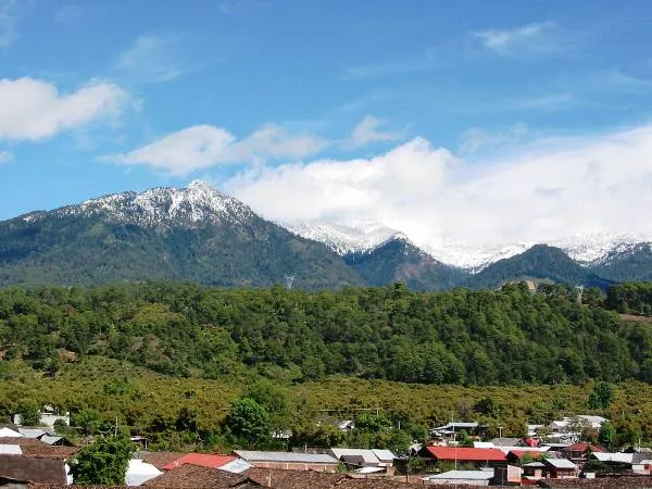
Risk profile for Tancítaro
People
37 violent incidents within 50 km in five years (UCDP).
For Mexico: crime extreme; US advisory Level 2 since 29 May 2026; CDC: Rocky Mountain Spotted Fever in Mexico.
Nature and health
Wildfires: 5 within 100 km in five years, mostly in April and March.
Emergency department 26 km away.
Risk score 70/100, lower is safer · method
How Tancítaro compares
Of the 53 towns we rate in Michoacán, 47 score lower (safer) than Tancítaro, 4 the same and 1 higher.
Across Mexico, 26 of the 982 towns we rate score higher than Tancítaro and 921 score lower.
| Risk layer | Tancítaro | Median, Michoacán |
|---|---|---|
| Health and medical access | 36 | 26 |
| Natural hazards | 80 | 71 |
Nearest towns in Michoacán with a lower score: Cherán (67, 58 km), Nahuatzén (67, 59 km), Cotija de la Paz (67, 63 km).
Same 0–100 scale as the score above · method
Ask about Tancítaro
Tancítaro month by month
November in Tancítaro: 17 to 30 °C, 17 mm of rain, about 11.2 hours of daylight.
Driest: April, 2 mm. Wettest: August, 155 mm.
Busiest months nearby in five years: April, 4 wildfires; September, 1 tropical cyclone and 2 strong earthquakes; October, 2 tropical cyclones.
Latest recorded near Tancítaro
- 17 Aug 2026 Flood
- 12 Jan 2025 Earthquake, magnitude 6.2, 140 km SW
- 22 Apr 2024 Wildfire, 38 km E
- 27 Mar 2024 Wildfire, 93 km SW
GDACS, USGS
About Tancítaro
Tancítaro is a municipal seat of Tancítaro, State of Michoacán, Mexico. It is in Tancítaro Municipality. Population 31,100 (2015). Founded in 1531.
Official site: ayuntamientotancitaro.gob.mx. More on Wikipedia: Tancítaro. Facts: Wikidata (CC0).
Getting help in Tancítaro
| Emergency department | Hospital Municipal | 26 km SE |
|---|---|---|
| Nearest hospital or clinic | Centro de Salud | 24 km N |
| Police | Comandancia Policía Municipal de Apatzingán | 30 km S |
| Railway station | Nueva Italia | 42 km SE |
| Airport with scheduled flights | Uruapan - Licenciado y General Ignacio Lopez Rayon International Airport (UPN) | 35 km E |
More hospitals and clinics: ISSTE, 26 km S.
Emergency number in Tancítaro: 911 for police, ambulance and fire.
Official advice for Mexico
Places near Tancítaro
Nearby risk scores: Tancítaro 70, Nuevo San Juan Parangaricutiro 68, Paracuaro 70; Mexico overall 64.
Advice alerts for Mexico · Embed this score
Been to Tancítaro?
Data last changed November 12, 2026 · Sources and licences