Destinations / Belgium / Wallonia / Flémalle-Haute
Is Flémalle-Haute safe to visit?
Flémalle-Haute travel safety: Moderate risk (32/100), November 2026
Yes, for most visitors, with ordinary care. The emergency department at Centre Hospitalier du Bois de l'Abbaye is 3.1 km away and floods are the main hazard on record, 21 in five years.
Checked 22 November 2026: no disaster alerts nearby in 14 days.
Now in Flémalle-Haute: 7 °C, partly cloudy, wind 15 km/h. Next 24 hours: 1 to 7 °C, no rain expected. Sunset 16:44.
Weather: MET Norway, 12:20 UTC.
Is Flémalle-Haute safe right now? Checked 22 November 2026
Flémalle-Haute scores 32/100 on our travel risk index (Moderate). The US State Department rates Belgium Level 2 (Exercise Increased Caution, updated 23 Jul 2026); the UK has no advice against travel; Canada says: exercise a high degree of caution. No GDACS hazard alerts within 100 km and no magnitude 5+ earthquakes within 150 km in the last 14 days. No change in government advice in the last 7 days.
Natural disasters (score 10)
Government advisory (score 25)
For Flémalle-Haute (Wallonia, Belgium) official advice is the national advice for Belgium: the US asks travellers to exercise increased caution (Level 2), and the UK has no warning against travel. In the last five years GDACS and USGS recorded 21 floods (mostly in May and June) and 2 wildfires (mostly in April and August) near Flémalle-Haute. The nearest hospital with an emergency department in our map data is Centre Hospitalier du Bois de l'Abbaye, 3.1 km SE. Flémalle-Haute scores 32/100 (Moderate) using town-level data; lower is safer.
Get a personalized assessment for your trip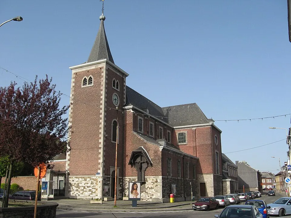
How safe is Flémalle-Haute to visit in 2026?
Flémalle-Haute currently sits at 32/100 on our composite travel-risk index, which puts it in the moderate-risk tier. Most travelers will be fine with normal precautions, but a few categories below score high enough that planning matters. The highest-rated risk category for Flémalle-Haute is government advisory (25/100), and the lowest is natural disasters (10/100). The guide text last changed on November 12, 2026; the baseline category scores reflect analytical indicators, layered with live conditions throughout the day. Live conditions — weather at most hourly (MET Norway), US State Department advisory every 6 hours, GDACS disaster alerts every 30 minutes, CDC health notices every 12 hours, and news every hour — are cached at the source and refreshed automatically when stale.
Driven by: security (36/100) and natural hazards (52/100).
A score of 32 is higher than 26% of the cities we score.
Risk profile for Flémalle-Haute
People
Nature and health
Floods: 21 within 100 km in five years, mostly in June and May.
Emergency department 3.1 km away.
Risk score 32/100, lower is safer · method
Ask about Flémalle-Haute
Flémalle-Haute month by month
November in Flémalle-Haute: 3 to 8 °C, 75 mm of rain, about 8.9 hours of daylight.
Driest: April, 52 mm. Wettest: December, 92 mm.
Busiest months nearby in five years: May, 4 floods; June, 5 floods; August, 3 floods and 1 wildfire.
Latest recorded near Flémalle-Haute
- 14 Aug 2026 Wildfire, orange alert, 44 km E
- 20 Jun 2026 Flood
- 30 May 2026 Flood
- 30 Apr 2026 Wildfire, 74 km N
GDACS, USGS
About Flémalle-Haute
Flémalle-Haute is a section of Flémalle, Belgium.
Facts: Wikidata (CC0).
Getting help in Flémalle-Haute
| Emergency department | Centre Hospitalier du Bois de l'Abbaye | 3.1 km SE |
|---|---|---|
| Police | Police de Flémalle | 0.5 km SE |
| Railway station | Flémalle-Haute | 0.9 km SW |
| Airport with scheduled flights | Liège Airport (LGG) | 4.4 km N |
More hospitals and clinics: Clinique des Houx, 6.8 km SW; Hôpital psychiatrique Le Petit Bourgogne, 6.9 km ENE.
Places near Flémalle-Haute
Nearby risk scores: Flémalle-Haute 32, Seraing 32, Montegnée 32; Belgium overall 28.
AI safety snapshot · refreshed Jul 21, 2026
Flémalle-Haute currently maintains a low risk profile with a baseline composite score of 21/100. Travelers should be aware of a Level 2 US State Department advisory and a Level 1 global health notice regarding dengue.
AI-summarized strictly from the live public-source data below (US State Dept advisory, GDACS, CDC, Google News). Auto-refreshed at most once per day on the first visit. Not official advice.
Live conditions last refreshed: Nov 22, 2026 12:37 UTC
What should I do now?
- Run a real assessment. Open the calculator for live data (weather, advisory, news) layered onto this baseline.
- Government advisory (score 25/100): Read your country's current official advisory within 7 days of travel. Register with your embassy on arrival if available.
- Crime (score 22/100): Use registered taxis or ride-share apps. Keep electronics out of sight in public transit. Read recent reviews for your specific neighborhood.
- Check your country's advisory. The single most authoritative live signal. Linked at the bottom of every real assessment.
Day vs Night Safety in Flémalle-Haute
Guidance based on our scores and official advice — not a measured score.
Daytime transit and exploration in central areas are generally safe and routine. Standard alertness in crowded transit hubs and tourist plazas is adequate.
After dark, keep to well-illuminated thoroughfares and busy dining/entertainment quarters. Use verified taxis or rideshare apps when returning late.
Safety by Traveler Type in Flémalle-Haute
Guidance based on our scores and official advice — not a measured score.
No group-specific warning is triggered in Flémalle-Haute for solo travelers (Crime 22/100 · Transport 18/100), women traveling solo (Crime 22/100), families with children (Health 15/100 · Natural disaster 10/100), older travelers (Health 15/100 · Transport 18/100), business travelers (Digital 15/100 · Money 15/100 · Transport 18/100) and lgbtq+ travelers (Advisory 25/100 · Political 15/100): these scores sit in the low-to-moderate range, so standard precautions apply. Local laws affecting LGBTQ+ travelers and gender-specific incident rates are not captured in our scores; check your government's travel guidance.
Pre-Departure Readiness
Travel Insurance & Medical Evacuation Readiness for Flémalle-Haute, Belgium
Standard domestic health plans rarely cover overseas trauma stabilization or inter-hospital transport. Carry at least $250k in emergency medical and evacuation protection, especially outside major urban hospitals.
Confirm coverage for regional transport, scooter/road incidents, weather disruptions, and any sub-national areas carrying a higher advisory than the national baseline. Standard travel insurance policies commonly invalidate medical, evacuation, and cancellation benefits in any territory under a US Level 4 ("Do Not Travel") or UK FCDO "against all travel" advisory unless a specialized high-risk rider is explicitly purchased.
Pre-Departure Document & Emergency Checklist
- Embassy alert enrollment: Register your itinerary with the US Department of State STEP program, UK FCDO travel alerts, or your home consulate before departure.
- Offline emergency contacts: Save your insurer’s 24/7 collect assistance line, policy number, and local emergency numbers by country offline on your phone and on paper.
- Medication & clinical records: Carry prescriptions in original pharmacy packaging with a signed doctor’s note; review controlled-substance rules on our medication travel checklist.
- Policy wording review: Check war/unrest, sub-national exclusion, and direct-billing clauses in our travel insurance exclusions guide and medical evacuation guide.
View complete category score breakdown & baseline metrics
Score layers
Safety categories
Source: Grounded open data research & citations
Quick facts
| Hospital access | high |
|---|---|
| Airport risk | low |
| Road safety | medium |
| Public transport | high |
| Tourist scam risk | low |
| Night safety | medium |
Live conditions in Flémalle-Haute
Real-time data refreshed from public sources — weather from MET Norway, official advisory from the US State Department, disaster alerts from GDACS, health notices from the CDC, news from Google News. For an AI-synthesized briefing tailored to your specific trip, run a personalized assessment.
Today's weather
⛅ Partly cloudy
Flémalle-Haute, Belgium
| High / low, next 24 h | 6.8°C / 0.6°C | Wind now / max | 14.8 km/h / 15.1 km/h |
|---|---|---|---|
| Humidity | 69% | Precipitation, next 24 h | 0 mm · — |
| UV (max, next 24 h) | 0.8 | Sunrise / Sunset | 08:04 / 16:44 |
Source: MET Norway (CC BY 4.0) · fetched 2026-11-22 12:20:41 UTC · cached
Official travel advisory
Level 2 · Exercise Increased Caution
Belgium - Level 2: Exercise Increased Caution
Read full advisory → · US Department of State
Disaster alerts
Active Disaster Alerts
-
Drought is on going in Albania, Austria, Bosnia & Herzegovina, Belgium, Bulgaria, Belarus, Switzerland, Czech Republic, Germany, Denmark, Spain, France, Croatia, Hungary, Ireland, Italy, Liechtenstein, Luxembourg, Montenegro, Poland, Romania, Serbia, Sweden, Slovenia, Slovakia, Ukraine, ORANGE · country-wide · 2026-02-11
The Drought notification level is Orange.
-
Green flood alert in France GREEN · ~264 km away · 2026-11-06
On 04/11/2026, a flood started in France, lasting until 16/11/2026 (last update). The flood caused 2 deaths and 170 displaced .
“~N km away” = event centroid within ~500 km of this location; “country-wide” = a national/regional alert that may not be near this specific city. Source: GDACS · fetched 2026-11-22 12:37:39 UTC
Natural hazard calendar & history
5-Year Hazard Calendar (100 km Radius)
| Hazard | Jan | Feb | Mar | Apr | May | Jun | Jul | Aug | Sep | Oct | Nov | Dec |
|---|---|---|---|---|---|---|---|---|---|---|---|---|
| Floods | 3 | — | — | — | 4 | 5 | 3 | 3 | 2 | 1 | — | — |
| Wildfires | — | — | — | 1 | — | — | — | 1 | — | — | — | — |
Most flood events within 100 km of Flémalle-Haute happened in June (5 of 21 in five years).
Source: GDACS, USGS; five years to November 2026.
For consular advice on women's safety, LGBT+ travel, and local laws, see the Belgium travel advice & laws.
Check the official entry requirements for your nationality before you travel. See the Belgium entry requirements.
Health notices
Health Notices for this Destination
-
Level 1 - Global Measles WATCH · 2025-05-28
Measles cases are rising in many countries around the world. All international travelers should be fully vaccinated against measles with the measles-mumps-rubella (MMR) vaccine, according to CDC's measles vaccination recommendations for international travel. Country List : Afghan
Source: CDC Travelers’ Health · fetched 2026-11-22 12:05:43 UTC
Emergency numbers (Belgium)
| Police | 101 |
|---|---|
| Ambulance | 112 |
| Fire | 112 |
| General | 112 |
Essential local emergency phrases
Show this screen to first responders, hotel staff, or passersby if you cannot speak the local language during an emergency.
Medical access
| Hospital access | medium |
|---|---|
| Pharmacy access | medium |
| Emergency response | medium |
| English-speaking care | unknown |
| Evacuation complexity | low |
The nearest hospital and emergency department is Centre Hospitalier du Bois de l'Abbaye, located 3.1 km from Flémalle-Haute. The nearest police station is 0.5 km away, and Liège Airport is 4.4 km away, suggesting relatively straightforward local access to care and evacuation.
Common scam patterns
- pickpocketing. Pickpocketing and purse snatching occur frequently in Belgium, particularly in major cities and transportation hubs such as train stations, metros, trams, and airports. Thieves often operate in teams using distraction tactics like bumping into targets or engaging them in lengthy conversations. Tip: Keep belongings secure and stay alert in crowds and on public transportation.
- fake police. In tourist areas, fake police and self-appointed helpers may approach travelers offering to assist with ticket machines or demanding to see documents. These are scams intended to distract or exploit visitors. Tip: Use official counters only and do not engage with strangers demanding to see documents.
- bag theft on trains. Theft of bags on trains has increased, particularly on routes such as Brussels-Amsterdam. Thieves often target light bags placed in overhead compartments or below seats. Tip: Keep bags with cash, valuables, and travel documents close to you rather than in overhead shelves.
Area notes
- Flémalle-Haute railway station area. Transportation hubs like train stations are common locations for pickpocketing and bag theft in Belgium.
- Centre Hospitalier du Bois de l'Abbaye vicinity. The area around the nearest hospital and emergency department, located 3.1 km from Flémalle-Haute, is a key service zone for medical needs.
Run a personalized assessment for Flémalle-Haute
Get a tailored briefing in ~15 seconds, with live weather, advisories, and recent news.
Calculate my trip riskScore history
| When | Score change | Tier | Reason / source |
|---|---|---|---|
| Nov 12, 2026 | 36 → 32 | moderate | Method change (scoring v2) scoring v2 |
| Sep 27, 2026 | 17 → 36 | low → moderate | Method change (scoring v2) scoring v2 |
Every editorial change to Flémalle-Haute's composite score is logged here, with the source and reason for the change. Live data overlays (weather, advisories, disaster alerts, news) refresh continuously on their own cadences and are not recorded as score changes — see the Live conditions section above for current overlay state.
Traveller reports from Flémalle-Haute
No traveller has reported on Flémalle-Haute yet. If you have been, your report helps the next visitor.
Transparency & Sources
We document the baseline sources, coverage scope, and data inputs for this destination below.
View full data sources, coverage scope, and registry notes
Sources used
- SimpleMaps World Cities (CC BY 4.0): Coordinates, region, population for Flémalle-Haute
- Travel Risk Calculator score (method v2): Security, crime and scams, health, natural hazards and current alerts for Flémalle-Haute, from US, UK and Canadian advisories, INFORM, World Bank, UCDP, CDC, GDACS, USGS and OpenStreetMap
- Editorial baseline (Travel Risk Calculator): City-level threat scoring across 9 categories (crime, health, advisory, political, disaster, transport, environmental, digital security, money safety)
Live data overlays on this page refresh asynchronously on the source cadences shown above. Run an assessment to create a trip-specific briefing using your dates and traveler profile.
Baseline scope
- Category scores represent an analytical baseline, updated from official feeds and public records.
Coverage notes
- Transport-hub safety notes (airport, train stations).
Methodology · Full data-source registry · Report a correction
Popular travel-safety searches right now
Cities our visitors look up most frequently — useful for trip planning, comparison, or just curiosity.
Disclaimer
Travel Risk Calculator provides estimated travel-threat information for preparation purposes only. It does not replace official government advisories, medical advice, emergency alerts, immigration rules, insurance advice, police guidance, embassy information, or professional security consultation.